Complex & Intelligent Systems ( IF 5.0 ) Pub Date : 2024-08-14 , DOI: 10.1007/s40747-024-01579-w Guanfeng Yu , Lei Zhang , Siyuan Shen , Zhengjun Zhai
|
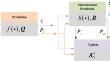
Vision-inertial navigation offers a promising solution for aircraft to estimate ego-motion accurately in environments devoid of Global Navigation Satellite System (GNSS). However, existing approaches have limited adaptability for fixed-wing aircraft with high maneuverability and insufficient visual features, problems of low accuracy and subpar real-time arise. This paper introduces a novel vision-inertial heterogeneous data fusion methodology, aiming to enhance the navigation accuracy and computational efficiency of fixed-wing aircraft landing navigation. The visual front-end of the system extracts multi-scale infrared runway features and computes geo-reference runway image as observation. The infrared runway features are recognized efficiently and robustly by a lightweight end-to-end neural network from blurry infrared images, and the geo-reference runway is generated through projection of the runway’s prior geographical information and prior pose. The fusion back-end of the navigation system is the Covariance Feedback Control based Cubature Kalman Filter (CFC-CKF) framework, which tightly integrates visual observations and inertial measurements for zero-drift pose estimation and curbs the effect of inaccurate kinematic noise statistics. Finally, real flight experiments demonstrate that the algorithm can estimate the pose at a frequency of 100 Hz and fulfill the navigation accuracy requirements for high-speed landing of fixed-wing aircraft.
中文翻译:
基于CFC-CKF的固定翼飞机实时视觉惯性着陆导航
视觉惯性导航为飞机在没有全球导航卫星系统 (GNSS) 的环境中准确估计自我运动提供了一种有前景的解决方案。然而,现有方法对于机动性高、视觉特征不足的固定翼飞机适应性有限,存在精度低、实时性差的问题。本文介绍了一种新颖的视觉惯性异构数据融合方法,旨在提高固定翼飞机着陆导航的导航精度和计算效率。系统的视觉前端提取多尺度红外跑道特征并计算地理参考跑道图像作为观察。轻量级端到端神经网络从模糊红外图像中高效、鲁棒地识别红外跑道特征,并通过跑道先验地理信息和先验姿态的投影生成地理参考跑道。导航系统的融合后端是基于协方差反馈控制的容积卡尔曼滤波器(CFC-CKF)框架,它紧密集成了视觉观察和惯性测量以进行零漂移位姿估计,并抑制了不准确的运动噪声统计的影响。最后,真实飞行实验表明,该算法能够以100 Hz的频率进行位姿估计,满足固定翼飞机高速着陆的导航精度要求。


 京公网安备 11010802027423号