Hydrogeology Journal ( IF 2.4 ) Pub Date : 2023-07-01 , DOI: 10.1007/s10040-023-02658-x
Nafyad Serre Kawo , Jesse Korus , Mats Lundh Gulbrandsen
|
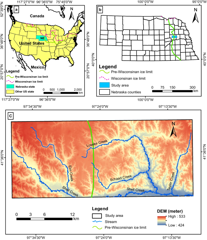
Quaternary glacial aquifers are important water sources for irrigation in many agricultural regions, including eastern Nebraska, USA. Quaternary glacial aquifers are heterogeneous, with juxtaposed low-permeability and high-permeability hydrofacies. Managing groundwater in such aquifers requires a realistic groundwater-flow model parameterization, and characterization of the aquifer geometry, spatial distribution of aquifer properties, and local aquifer interconnectedness. Despite its importance in considering uncertainty during decision-making, hydrofacies probabilities generated from multiple-point statistics (MPS) are not widely applied for groundwater model parameterization and groundwater management zone delineation. This study used a combination of soft data, a cognitive training image, and hard data to generate 100 three-dimensional (3D) conditional aquifer heterogeneity realizations. The most probable model (probability of hydrofacies) was then computed at node spacing of 200 × 200 × 3 m and validated using groundwater-level hydrographs. The resulting hydrofacies probability grids revealed variations in aquifer geometry, locally disconnected aquifer systems, recharge pathways, and hydrologic barriers. The profiles from hydrofacies probability at various locations show spatial variability of the streambed and aquifer connectivity. Groundwater-level hydrographs show evidence of these aquifer characteristics, verifying the general structure of the model. Using the MPS-generated 3D hydrofacies probability and hydrologic data, a novel workflow was developed in order to better define high-resolution groundwater management zones and strategies. In general, the conditional probability of hydrofacies helps improve the understanding of glacial aquifer heterogeneity, the characterization of aquifer-to-aquifer and streambed-aquifer connections, and the delineation of groundwater management zones. This MPS workflow can be adapted to other areas for modeling 3D aquifer heterogeneity using multisource data.
中文翻译:
三维冰川含水层异质性的多点统计建模,以改善地下水管理
第四纪冰川含水层是许多农业地区灌溉的重要水源,包括美国内布拉斯加州东部。第四纪冰川含水层是非均质的,具有并列的低渗透性和高渗透性水相。管理此类含水层中的地下水需要真实的地下水流模型参数化,以及含水层几何形状、含水层特性的空间分布和局部含水层互连性的表征。尽管在决策过程中考虑不确定性很重要,但多点统计(MPS)生成的水相概率并未广泛应用于地下水模型参数化和地下水管理区划定。这项研究结合了软数据、认知训练图像、和硬数据生成 100 个三维 (3D) 条件含水层异质性实现。然后以 200 × 200 × 3 m 的节点间距计算最可能的模型(水相概率),并使用地下水位过程线进行验证。由此产生的水相概率网格揭示了含水层几何形状、局部断开的含水层系统、补给路径和水文障碍的变化。不同地点的水相概率剖面显示了河床和含水层连通性的空间变化。地下水位过程线显示了这些含水层特征的证据,验证了模型的总体结构。使用 MPS 生成的 3D 水相概率和水文数据,为了更好地定义高分辨率地下水管理区域和战略,开发了一种新颖的工作流程。一般来说,水相的条件概率有助于提高对冰川含水层非均质性的理解、含水层与含水层之间以及河床与含水层连接的表征以及地下水管理区的划分。此 MPS 工作流程可适用于其他领域,以使用多源数据对 3D 含水层异质性进行建模。


 京公网安备 11010802027423号